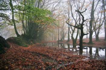
A big thank you to all of you for attending today's event despite the conditions. As many of you are probably aware, we had our permissions pulled just a week before we were due to host the event earlier this year, so it was good to finally make the event happen. Updated with Organiser, Planner and Controller comments.
A big thank you to all of you for attending today's event despite the conditions. As many of you are probably aware, we had our permissions pulled just a week before we were due to host the event earlier this year, so it was good to finally make the event happen. I must say a big thank you to all the helpers that made the event possible, and in particular those manning the starts in probably the most exposed part of the Quantocks imaginable. A big thank you as well to the Planner, Phil and the controller Chris, who spent most of Saturday and Sunday battling the elements placing the controls.
I apologise for the delay in setting runners off. This was due to the controller and planner being unable to access the forest at the planned 7am due to the fallen tree, and also because I was struggling to get around the various other fallen trees and flooded roads on the Blackdowns. You will be pleased to know that it only took the 3 of us 20mins to get through the fallen tree with a small carpenters saw and a car jack.... The bow saw arrived shortly afterwards.....
We hope you enjoyed revisiting this part of the Quantocks, and we hope to see you all at the next event
Planner comments from Phil:
Firstly a huge huge thank you to the helpers - some of whom went control collecting after getting drenched whilst volunteering at the start, which is impressive dedication. A special thank you as well to the SI-team lead by Andy and the permissions team (Andrew and Rosie) for all their hard work behind the scenes for an event like this.
Secondly thank you to everyone who braved the weather to come to the event - I completely appreciate for some it was best to stay at home (I include my family in that camp!) but I am glad a good number of people got to take part in the event.
The biggest challenge on a lot of the Quantocks is to give orienteers interesting terrain to run through whilst trying to avoid too much height gain or path running. For the longer courses this inevitably meant visiting at least some of the combes, but I hope you appreciated the variety of terrain and the chance to visit rarely used areas.
The parking field that used to be used at Triscombe Stone is no longer available to us, so the idea was discussed (in the pub after a BOK urban) to used the forest track for parking, which opened up adding the fast, furious (and relatively runnable) area in the forest at the end.
With hindsight the start was too exposed and it should have been in the wood, and the out of bounds area to discourage people cutting back through the start was based on the original planned location of the start before it was moved further down the hill so it accidentally became a plausible route choice again.
It was a real shame we lost permissions for the small wood by Wills Neck - it is very runnable and set up competitors for their legs onto the open moorland. Losing the area meant that cutting through the gorse to 128 became more of a route choice for several courses that I had originally planned. We had tried to make the green boundary as obvious as possible on the map (compared to the much nicer access from the South) but with hindsight the green shades are not clear on the printed map (on Routegadget it is more obvious). Apologies to everyone who forced their way through the gorse (and to Chris who predicted it might be an issue after trying that route).
Short Green was especially impacted by losing the woodland controls as it was a bit of variety from the moorland. Planning Short Green was especially hard as you have to have at least one of vegetation, height gain or path running.
This was my first proper event that I have planned. There are certainly improvements that could be made (for next time?!), but ultimately most of the win times were as planned which is reassuring (and an improvement from Ham Hill's 2x2 relay!).
A big thank you to Brian for all the ongoing surveying and map updates he did to get the map up to a good standard - he even ran non-competitively so he could survey likely route choices for my planned courses.
A massive thank you to Chris, my controller, who put in so much time and effort on this event. My courses were better, safer and more interesting thanks to his feedback. He was out in the rain with me on Saturday putting out the remote controls, and he helped put out controls on the day (again in the rain and in a rush thanks to the fallen tree issue).
Highlights for me was hearing some fantastic positive feedback, having support from some very dedicated helpers, and watching Ollie try to cut a tree with the most impractical saw ever (but it worked!)
Controller comments from Chris:
I’d like to add my thanks to everyone involved in putting on this event and to those competitors who managed to get there and make all the effort worthwhile. I think numbers on the day were down by about 50 on entries, but that’s understandable given the conditions over the weekend. Phil made good use of the area offering some varied terrain and the winning times were generally about right, so I hope most of you enjoyed the courses despite the weather. Brian did an excellent job with the map; keeping up with vegetation changes and accurate undergrowth screens is difficult on the common, as well as mountain bike tracks in the woods which sometimes appear overnight. Fortunately the cold spell just before the event helped with bracken die back just in time, although there are still some quite gnarly areas of gorse which most of you will have encountered. Loss of permission for the nice flat runnable woodland in the far south was disappointing, especially as BML had already prepared proof maps at that stage, but Phil’s last minute adjustments recovered the situation as well as possible. And finally the fallen tree, quite small but large enough not to be crossable. Phil and I were very close to thinking we’d need to cancel the event, so Ollie’s timely arrival with a saw certainly saved the day even if some of you had to wait a bit longer for your starts.
Show Pre-Event Info
Forest League 2024/25 Series Info
Our league events are open to all, beginner or experienced orienteer, young or old and there are colour-coded courses suitable for all.
We have five of these events a year and together they form the Forest League (QOFL). The series starts in the Autumn and continues at approximately one event per month until the spring.
Please note that for the 2024/25 season, all our league events will be Regional events (Level C).
Anyone can get a result for an event, but for it to be included in the league scoring you have to be a member of a British Orienteering affiliated club at the time of entry.
Please note that if you are coming from the direction of Taunton, the road from the crossroads (where the Pines Cafe used to be) via Lower Aisholt is liable to flood after heavy rains (the blue route below - the red line being where it floods). It is usually passable depending on vehicle clearance and how risk adverse you are. The best alternative route is marked in yellow - head towards Bridgwater then take the left turn towards Merridge at the old pub (it adds about 5 minutes). There is also a small road marked in green to switch routes last minute.
Parking is on a forest track, accessed from here: Google Maps (straight ahead at Triscombe Stone LOWER car park)
Follow the directional arrows to the end of the valley and then follow the forest track around to the left. Drive past the event centre and a parking marshall will direct you to a suitable space. The forest track is steep in places, and slightly rutted, so best to leave the Mclaren at home...
Due to the parking being on a narrow forest track and there being a need to maintain a one way system, you will not be permitted to leave the event until after 1pm.
Maximum speed on the forest tracks is 15 mph.
Please take care on the track especially as you go past the event centre as there will be pedestrians crossing. Please ensure there is space for vehicles/people/horses to pass as this is also a Bridleway.
Distance from the parking area to registration/ the event centre will vary, but should not be more than 300m.
Course Information
Map A4 1:10000 for all courses. Contour interval 5m. Map has been significantly updated by Brian Pearson.
Control descriptions on the map and available in start box. White and Yellow text/Orange text and pictorial, all others pictorial. On the brown and blue maps, the map key is covered by the control descriptions.
Unfortunately we have lost permissions last minute for a small yet lovely and runnable wooded area that most of the adult courses visited. We have managed to re-plan the courses to avoid the area without losing too much length but please note there has been some changes to the details below.
Course
Length (km)
Height Gain (m)
Controls
Brown
6.8
410
24
Blue
4.7
240
17
Green
3.4
180
14
Short Green
2.8
115
13
Light Green
2.9
110
14
Orange
2.5
85
10
Yellow
1.8
70
9
White
1.2
50
10
All courses will be exploring open moorland and woodland, and most will visit patches of quite runnable woodland on and around Will's Nick with stunning views both East and West. There is a mixture of fast and less fast open, runnable and less runnable woods and other interesting terrain.
Re-wilding means the vegetation is constantly changing on Quantocks - the map has been updated regularly over the last year, however please do not rely on mapped vegetation for fine navigation.
On the white course there is a small leg that will be tapped to help participants navigate a tricky path junction.
Please note:
There is a steep sided gulley and a steep re-entrant in the event area. Neither is a good route choice and should be avoided.
Please be extra vigilant if passing through an area containing pits (marked on the map) - most are shallow but should be avoided.
Ponies, and occasionally cattle/ sheep present in course area. Participants advised to give a wide berth when nearby.
To the North West of the event area there is a quarry that is fenced and marked as OOB. Most courses do not go near it and whilst some Senior courses are in the vicinity, the fencing is sufficient to prevent accidental entry. There are no fences that need to be crossed on any course at any point.
Paths and tracks are seasonal - some smaller paths may be mapped if it aids navigation, but plenty are not mapped. Only larger dens are mapped - others may appear and disappear at the whims of children visiting the area.
The woodland around the finish is used by unauthorised mountain bikers - please exercise caution especially if you are using any of the mapped bike tracks.
Entry Details
Class
Pre-entry
Late / On the day entry
Senior
£10
£12
Senior Novice
£5
£6
Junior
£5
£6
Group
£7
£9
Junior - anyone 21 years or younger at the time of the event, regardless of the course they are running.
Senior novice - an adult running White, Yellow or Orange.
Group - all going round a course together, two maps provided.
A standard SI dibber can be hired for free (or £2 for a contactless SIAC dibber). Failure to return it will incur the cost of a replacement (£30 for SI, £60 for SIAC).
Start times from: 11.00 to 13.00 (helpers can start from 10.30)
Courses close: 14:30 - Please report to download by this time even if you have not completed your course.
The routes from the event centre to the start, and from the finish back to the event centre will be marked by tapes. Please follow these and do not use the mountain bike tracks as a shortcut. There will be a bag drop on the route to the start and on the way back from the finish.
Event centre to the start = ~1.2km. 65m climb Finish to event centre = ~850m. all downhill
There is a grassy area (on a slight slope) at the event centre for small tents and shelters - please do not block the cycle track that cuts through.
Facilities
Toilets
Due to the location of the event centre, we have not been able to secure a portaloo for the event. The nearest public toilets are in Great Wood, approximately an 8min drive away from the entrance to the forest road.
Safety information:
Safety
Please dress according to the weather – waterproof may be compulsory as the hilltop is exposed.
Whistles are required and will be checked at the start.
Leg covering - required Waterproofs - depends on weather Whistle - required
Be tick aware: check for ticks on your body after the event and ensure any are removed safely. Be aware of what to look out for, e.g. circular or bulls-eye rashes, and what to do: More information about ticks.
Bio security measures should be followed as an area of the woodland has recently been categorised as “infected” - Check. Wash. Clean. Dry. Please ensure all your kit is cleaned before and after visiting the area.
Contacts / Officials
Planner: Phil Sorrell 07813 037087 website@
Controller: Chris Kelsey (BOK)
Organiser: Ollie Rant 07514 084619 spunch@
Important Event Information
Safety and Risk: A comprehensive risk assessment will have been carried out by the organiser, but participants take part at their own risk and are responsible for their own safety during the event. All participants must report to download whether they finish their course or not.
Privacy: when participating in our events/activities your name may appear in the results section of this website or in newspaper reports. Read our data protection page to see how we look after your personal data.
Photography: QO has an agreed policy on the taking of photographs at events, based on national guidance. This provides a sensible balance between the benefits and risks associated with the taking and use of images. If you are unsure about acceptable practice, please speak to the event organiser.
Safeguarding: QO is aware of it's responsibilities in safeguarding and child protection. To comply with The Child Safeguarding Practice Review and Relevant Agency (England) Regulations 2018, we now provide an email address for individuals to report concerns to the Lead Safeguarding Officer. This address is safeguarding@britishorienteering.org.uk.