Smartphone course
at Longrun Meadow
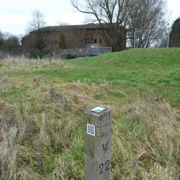
Longrun control post with QR code
Credit:
Roger Craddock
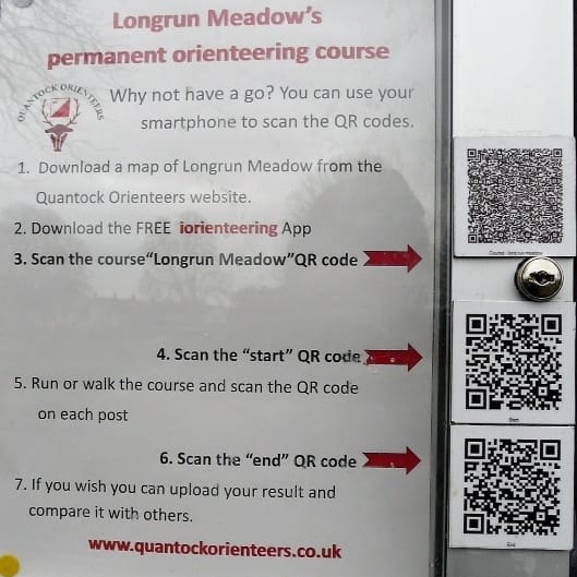
The existing permanent course at Taunton's Longrun has been upgraded to include Quick Response (QR) codes, which are readable by smartphones. Map
Users can now time their runs and obtain control split times.
Links
Permanent courses (POCs) in our area, including Longrun
More tech
While the QR codes enable virtual races to take wherever control posts exist, including woods, another method has emerged but this time suited more to score events in urban and semi-urban areas.
A little experiment has begun in the Holway & Blackbrook area that we've used for urban orienteering before. A trial course has been set up using MapRun (also known as MyOMaps). MapRun is an app which does away with the need for kites, control units or permanent course posts.
Credit: RC
Basically, it relies on GPS readings (pinpointed from Google Earth) of locations of street furniture, typically lamps and post boxes. Quite a few in the club will already be familiar with urban score events using street furniture where you take a note of say a lamp post number to prove you've visited the site.
With the new method, your control 'punches' are registered via a smartphone, which vibrates or buzzes when you're within a couple of metres of the control. First though you need to download the event onto your MapRun app and activate your run via a PIN code obtained from the organiser. Afterwards you have the option to upload your result onto the event leaderboard online, via a single click. Automatic postings to Routegadget are also possible.
Traditionalists can be reassured - paper maps are still used!
Link