Next Club Night
JOG awards & MapRun
A Trailblazing Jim makes it back
Before the JOG presentations on Thursday, there is another opportunity to try out MapRun, this time using a significantly updated map of the Longrun, Roughmoor and North Town areas of Taunton! Contact Roger and Judy Craddock to register your interest.
You use a smartphone (some are available to borrow) to try the course, created with MapRun, an app which uses GPS signals for controls. The courses variously use parkland, streets, precincts, alleyways and riverside paths.
On Thursday night we will be mainly using the Chip Lane to Longrun course. You won't be able to use that till then, as it's protected by a PIN number! We will print off some weather-proof maps. These two things aside, please follow the guide that follows, which also applies for using any of our MapRun courses. If you'd like to run a course that's simpler or traffic free, let us know so we can print maps for that too.
Preparation
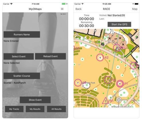
Go to the course list and pick a course!
- Read the course details
- Print a copy of the map off
- Please download the MapRun app onto a smartphone, if you have one; here's the links: iOS (Apple), Android
- The basic app is free and sufficient for this exercise.
- The paid for app is $6Aus (£3.50) and has more features.
- Choose the event from the MapRun Server to load onto your app; it'll be in the MR UK / MR Quantock Orienteers folder
Please take with you
- The map
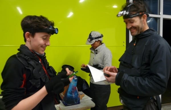
- A smartphone. Please ensure if has plenty of charge. The device needs to have a GPS chip, otherwise it can't "read" the virtual controls!
- If you have an armband for your phone, so much the better. You only need to look at it to check your virtual 'punch' has registered. The club also has a limited number available to borrow.
- Suitable footwear (over winter, Longrun has churned up on some paths and around its gates)
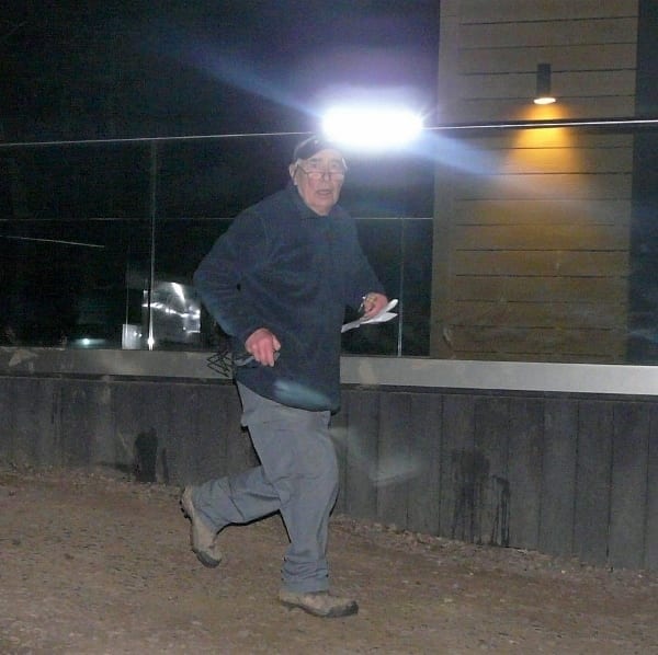
- If you're intending to venture out onto Longrun in the dark, bring a headtorch, a spare, spare batteries, a whistle and a compass if you normally use one.
Please note
You are responsible for your own safety on the course and take part at your own risk.
The courses
Are 'score' courses; a score means you can take the controls in any order you like. The value of each control is determined by its lead number e.g. 36 will score you 30 points. The time you're given is included in the course details and printed on the map. You can take longer but penalty points are deducted!
One course is traffic free. Others use streets but are bounded by busy roads, while others cross busy roads using crossing points marked on your map.
Bagging all the controls usually involves a route varying from 2.5k to 10k depending on the course. But you don't need to go nearly as far as that to see the app in action!
It's not necessarily a serious competitive exercise but you may want to challenge yourself. You can return to the terrain at any other time of your choosing to try it again, again to a time limit. If you don't fancy venturing out onto Longrun or urban streets, you can do a short, simple loop round French Weir Park instead.
The Start is usually a prominent feature and shown in a photograph on each event page. For example, for the Longrun courses, it's a lamp post just to the south of the COACH building, adjacent to the bridge between Longrun and French Weir Park.
Don't visit the Finish till you actually need to! As with any virtual control, it will register when you go within a few metres of it. Though if you still have controls left to visit, the app prompts you whether you are sure you actually want to finish.
After finishing, the app prompts as to whether you'd like to upload your results to the MapRun website to compare against others.
Introduction to MapRun
MapRun is best suited to events in urban and semi-urban areas.
MapRun, also known as MyOMaps, doesn't need kites, control units or permanent course posts. Witness the impressive ways a neighbouring club in the South West is already using it, following the links - see further below.
Basically, MapRun relies on GPS readings (pinpointed from Google Earth) of locations of street furniture, typically lamps and post boxes. Quite a few in the club will already be familiar with urban score events using street furniture where you take a note of say a lamp post number to prove you've visited the site.
With the new method, your control 'punches' are registered via a smartphone, which vibrates or buzzes when you're within about five metres of the control. First though you need to download the event onto your MapRun app and activate your run via a PIN code obtained from the organiser. Afterwards you have the option to upload your result onto the event leaderboard online, via a single click. Automatic postings to RouteGadget are possible but not for this occasion.
All courses have already been tried out.
Traditionalists can be reassured, despite all this technology, paper maps are still being used!