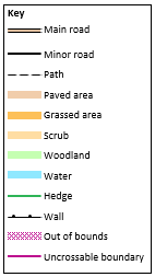
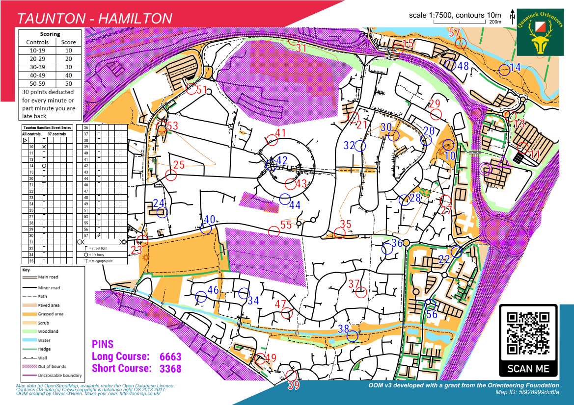
Making a Street Series Map

Maprun
A few tips and resources for making a street series map.
Creating the PPen File
Traditional Option
Use the pdf you created in OOMap and plot the points manually. There is a risk of mis-placing or mis-numbering controls. And it takes time.
New Recommended Option
When the courses are loaded, the Maprun Administrator can send you the PPen files this creates. The controls will thus be in the right places already.
Course Information
We use the same maps for both courses, so no need to be clever setting the information in the description.
You will need to include the PIN for each course, which is provided by the MapRun administrator.
Also, put the time limit somewhere clear.
Control Descriptions
For Street Series, we make a few standard substitutions to symbols:
shooting platform = streetlamp
tower = telegraph pole
fodder rack = flagpole or CCTV (as needed)
x = bench
o = noticeboard
The last two are general special items and can be used for other things if needed.
On the map we just include a statement that 'all are on streetlamps apart from' and then put in a condensed CD list.
If you want to do the CDs without streetlamps, copy the PPen file, delete the streetlamp ones and then screenshot the CDs on that, importing it as an image back into the original PPen file.
Images
Add the scoring information, key, club logo and 'About Us' QR code into PurplePen in suitable gaps on your map.
The files needed for this are at the bottom of this page.
Settings and Fiddling
Add the central dots to the controls. Make sure these are positioned on the correct side of the road for the streetlamp or whatever. This is a safety thing as it allows competitors to plan for the minimum of road crossings.
Make sure that the positioning of the control numbers doesn't obscure anything that would be needed. Also make sure it is clear which control each refers to.
Consider adding gaps to control circles if they obscure a key piece of info.
Don't include whitespace around the control numbers as this will cause issues later.
Add in any impassable boundaries. Often these will be fences that haven't shown up on the map or places where it looks like there is a way through but there isn't.
Add any OOB areas, especially roads with a limit higher than 30mph and private land that looks like it might be crossable otherwise.
For OOB and uncrossables, pay particular attention to things which may be open for some of the time but closed for others. Parks closing at dusk are a classic example of this.
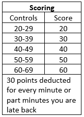
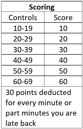
Colour-Coding for Long Score Course
For the long score course, we tend to colour odds and evens red and blue to make it easier for runners to spot the difference.
This is possible in OOM.
Start by creating everything in PurplePen as usual. Then export to .ocd.
Import that into OOM.
Now the faffy bit:
define colour red
define colour blue
duplicate control circle icon
duplicate control number icon
redefine one of the control circle icons as blue
redefine the other as red
redefine one of the control number icons as blue and add white around it
redefine the other as red and add white around it
select one set of control circles and change symbol to the other coloured one
select one set of control numbers and change symbol to the other coloured one
move templates like the key and the logos, up the layers so they are visible
Accessible Map
Finally, consider wheelchair access. If, as is likely, there are issues with this, create a second map and remove any controls that can't be accessed and add extra uncrossable boundaries where access would be impossible.
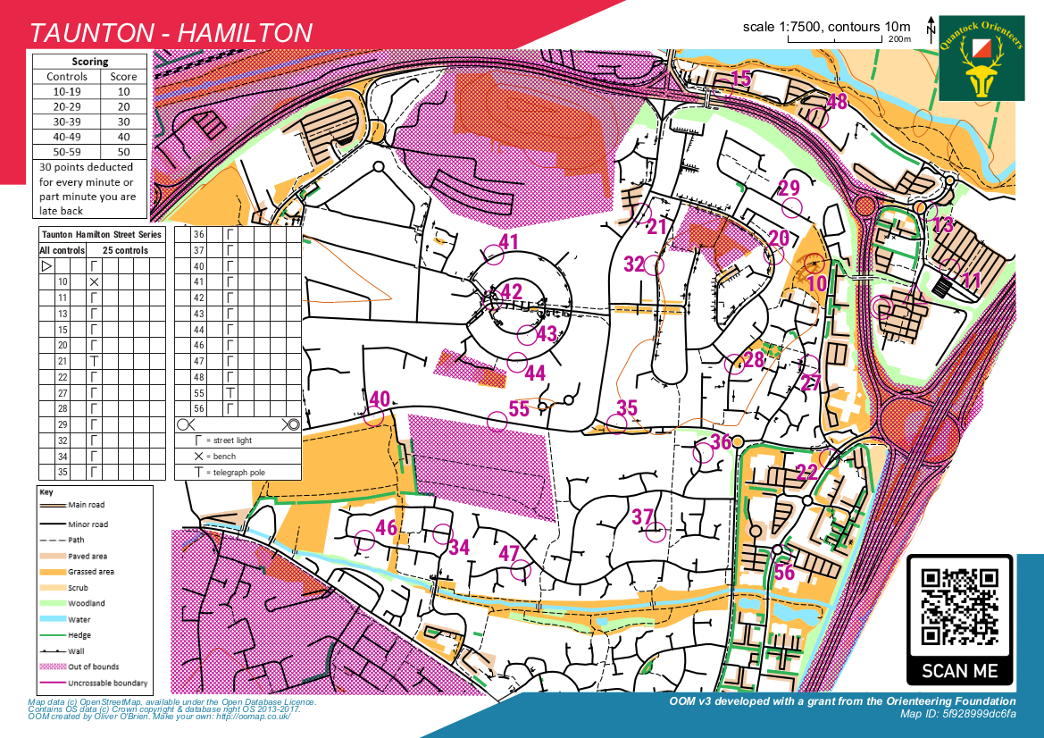
Photo Gallery