Extra event / series info
Please read before competing!
MapRun
This information is common to all future planned Street series evening events, which use the MapRun app.
Only the bare facts and details specific to any one event are shown on its event page.
Therefore, please read the details that follow before competing. This applies particularly to newcomers.
Fixtures
Please note that event files are now in MapRun's Somerset folder, as the developer's file structure reflects counties rather than individual clubs.
See each event page for more details.
Quick Start
Preparation
Please ensure the smartphone you intend to use has:
- GPS capability
- A fully charged battery, ideally (the app might use half of this charge)
- The latest version of the MapRun app installed
- The course you intend to run pre-loaded
- The GPS facility activated
The final version of the courses will be available to download onto the app 48 hours before the event at:
UK / Somerset / Street Series / (event name) / (event name & name i.e. Long or Short)
There will not necessarily be free WiFi at the assembly of every event. Please aim to upload the courses onto your phone before you turn up.
You can also try out some of our permanent courses, such as Taunton North, Longrun Meadow and Wellington Basins, with a view to getting your phone set up correctly.
Equipment
Please wear or try to bring:
- an arm holster for the smartphone
- running shoes with decent grip (for grassy slopes and areas with light mud)
And if you're running after dusk:
- a headtorch plus a spare, or spare batteries
- clothing with a hi-viz element or flourescent panels or trim
Visiting a control
Your phone should beep when you get within 10m of the "control".
Occasionally, your GPS signal may drift- you may have to wait a few moments for it to 'catch up'.
Our GPS controls tend to be located on lamp posts where the GPS controls work well. Wooden telegraph poles, signs and other street furniture, fences, bridges and play or sports equipment in parks may also be used. Those controls that are not on lamp posts will be listed on the map and on control description sheets.
If you're sure you've been at the control without getting a 'buzz', move on quickly to the next one. "Near misses" are easily detectable on RouteGadget and we will award you the points afterwards.
The exception is if you're running the Long course, both when you start and you're 'telling' the app which colour you're selecting and when you move to the next colour you need to string two together. That means that an accidental punch of a wrong colour is ignored.
Further details provided at the start.
Map
Unless the event details say otherwise, it is produced from Open Orienteering Maps (OOM) at a scale of 1:5000.
An OOM map contains more detail than a basic 'stick' map of the streets, but less detail than OCAD maps. Please note the blue used in rivers and streams doesn't look too different to the green used for woods.
Forbidden routes will be marked by a purple cross or a series of these, most obviously for safety and access reasons.
They are occasionally used to exclude from your route choice an option which doesn't present a technical challenge i.e. a long straight road.
Link: read more about the technical aspects of the map
Safety
We are using predominantly residential areas with 30mph speed limits. These areas are sometimes bounded by faster roads, which there should be no need to cross.
You are encourage to use any non-compulsory crossing points marked on the map. The symbol is two purple curved lines.
Forbidden routes are marked with purple crosses.
The above two symbols can look similar- take care!
Barriers - public fences and walls should not be crossed unless they can be without climbing and danger of injury to competitor or damage to the barrier.
Please show courtesy and understanding towards those you encounter on your run. A friendly 'hello' can often smooth the way.
You must take a paper map with you and should not rely on the onscreen map, which may not be the most up-to-date version of the map.
All participants must return to the assembly point before course closure time of 8pm, even if they have not completed their run. Results must be uploaded to the server at that point.
Under 16s taking part must be accompanied by a responsible adult at all times on the course.
Afterwards - social
Afterwards, why not stay behind to compare your routes and watch the leaderboard take shape as each runner gets back? Your route is automatically recorded on Routegadget. To facilitate this, we try to assemble at or near pubs with WiFi signals.
There is usually a good discussion on our forum.
League scoring
If you score maximum points, when we calculate the league scores you will earn a 20 points bonus for each full minute you take under the time limit.
In order to compete for QO's night owl trophy you would need to run the Long course as only that course will be used to determine the series winner.
Photo Gallery
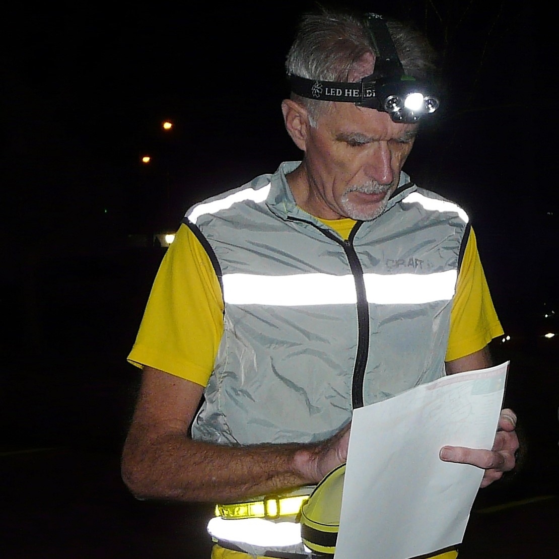
Credit: Judy Craddock