Planner's comments
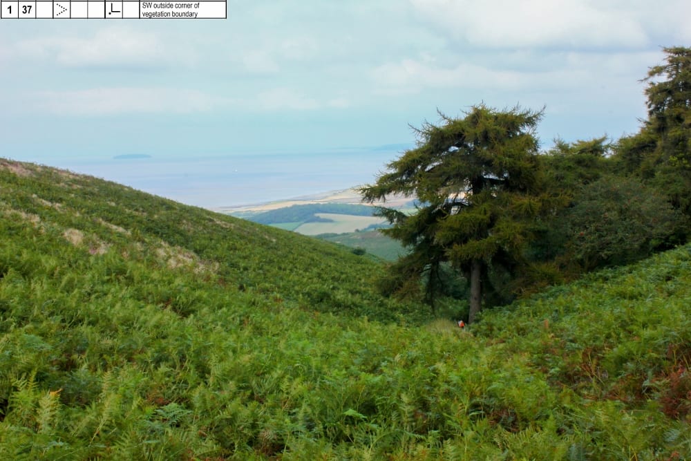
For an area like St Audries, an ideal scenario would be to visit and plan a year before the event when we know the state of vegetation. A few adjustments could then be made for heather burning and newly mowed areas. My first visit was in mid September and I faced abundant high, green bracken seemingly everywhere. I was relieved when it started to die off and open up the access. A fair few trips were required to selectively update the map but the views and scenery made it time well spent.
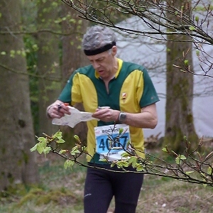
The map was updated for undergrowth walk or run rather than the type of vegetation, especially the seasonal bracken. The dark green was retained from the previous map for unpassable which marked the higher gorse. For the first control on Greens and Blue I wanted to gaffle and chose three sites in the thickets, the hardest and most distant being #108 for Blue and Short Green No.2. I was pleased that the results showed the majority had found it reasonably well and to watch several run straight in, but realised the map could have been more helpful with the undergrowth screen here for those who missed.
South of this the area on the slope that had controls #141 #116 #130 on trees and cairn proved to be tricky for all the courses. The contours tended to pull people up the convex slope and resulted in some overshoots. However for example, it was 270m from #117 to #130, with most of the 8m climb in the early part so it felt pretty flat along the red line to me, following the edge of low gorse and burnt heather.
Splitsbrowser on Routegadget only revealed one other leg where a few people had trouble and that on White, a short 50m leg #3 to #4 across a complicated junction but you all found it within a few minutes and without sad face signs.
I enjoyed working with Jim Mallinson [the controller], there is always something to learn and hope you appreciated getting some climb out of the way before the Start that was originally going to be in the forest. I employed some good mobile phone apps that helped with the fieldwork, Oribooklet and GPX Viewer- worth checking out.
- Brian Pearson
Photo-O competition
You may have tried this before, but in case you haven't....
Think you know St Audries well now that you've run there again? Then have a go (as Brian did) navigating through St Audries in the height of summer, bracken and all- as viewed through a camera lens. Steve Robertson's fabulous photo-O is a great way to practice 'reverse visualisation'- working back from how it looks on the ground to the control descriptions.
The link is here.
Retr-O event
Bristol OK's Gavin Clegg recalls his first ever event, also at St Audries, nearly half a century ago.
Link to article here
Show Pre-Event Info
Forest League (QOFL) Series Info
A local event open to all, beginner or experienced orienteer, young or old and there are colour-coded courses suitable for all.
We have six of these events a year and together they form the Forest League (QOFL). The series starts in the Autumn and continues at approximately one event per month until the spring.
Link to QOFL team lists - members, please check which events you are down to help at
Directions / Parking
Signed from the busy A39 at grid reference ST 114 424, roughly halfway between Williton and Kilve.
Free parking on a forest road, accessed from the busy A39. As space is limited, please car-share if possible.
The forest road can be steep in places. Please follow the marshall's instructions. Exit by the same road.
The assembly area is at ST 117 420.
Course Information
Suitable for all ages and abilities.
The course lengths and climbs below are provisional on final planning.
| Course | Length | Climb | No. of controls |
|---|
| Blue
| 5.2 km | 240m | 13 |
| Green | 3.8 km | 135m | 9 |
| Short Green
| 2.7 km | 75m | 11 |
| Light Green
| 3.3 km | 90m | 9 |
| Orange
| 2.9 km | 90m | 7 |
| Yellow
| 1.9 km | 40m | 6 |
| White
| 1.7 km | 35m | 10 |
Colour coded courses explained (with thanks to Berkshire OC)
The distance to the Start from Assembly is 500m with 60m climb. From Finish to Download it's up to 300m, depending on the course.
Entry Details
We urge you to join a recognised orienteering club once you have participated at three or more events. You then continue to be covered by British Orienteering's event insurance cover. Read about joining QO here.
2019/20 event charges
| Category of entry | £
|
|---|
| Adult
| 8
|
| Junior
| 3
|
| Family*- separate runs
| 16
|
| Group (1 dibber and up to 2 maps)
| 8
|
*The family rate is a concessionary rates. Maximum two adults per family.
SI card (dibber) hire - £1 (standard type not SIAC)
Additional runs (for all)- £1 each
Charge for lost dibber - £40 (SI).
Filling out a Registration form (link) in advance will quicken up the entry process on the day.
The non-member premium has been dropped for 2019/20.
Registration & Start Times
Registration from: 10:30 (helpers from 10.00)
Start times from: 11.00 to 13.00 (helpers can start from 10.30)
Courses close: 14:30
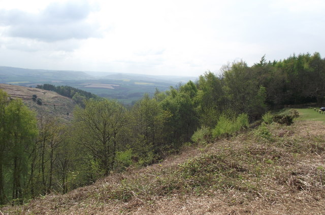
Terrain Description
Mainly open hillside and hilltop, cut through by several deep combes.
Dog restrictions
Dogs allowed but must be under control at all times.
Map
Generally heather & gorse are mapped where it is in significantly large areas. Where it is in small areas that can be easily circumnavigated, it generally will not be mapped.
The bracken has not died down, and if all areas were mapped with the undergrowth screen, most of the map would be green.
Courses have been planned to avoid the worst areas, which are generally on the lower, steeper slopes of valleys and re-entrants, but areas that may affect route choice have been mapped.
However, it should be noted that these areas should only be used for guidance, not for accurate navigation unless accompanied by the 'distinct vegetation boundary' symbol.
Horses and sheep graze the area and as a result there are numerous small animal tracks which have not been mapped. There are also a number of old indistinct vehicle tracks which have not been mapped.
Safety
This part of the Quantock Hills is an area of high level, exposed terrain, frequently with low cloud, wind and rain (and snow). Due to the high and exposed nature, all competitors are required to carry (and know how to use) a whistle. All competitors must download even if you do not complete the course.
In the event of bad weather, the carrying of whistles and wearing of cagoules will be compulsory for all competitors, so competitors should come prepared.
First aid
First Aider at registration.
The nearest A & E Hospital is at Musgrove Park Hospital, Taunton, TA1 5DA.
The nearest Minor Injuries Unit is at Minehead Community Hospital, TA24 6DF.
Extreme weather cancellation policy
In the event of severe weather, the event may have to be cancelled at short notice. Please check this website before travelling.
Final Details (downloadable)- click here
Contacts / Officials
Planner: Brian Pearson (QO) 01823 252407 results@
Controller: Jim Mallinson (SLOW/QO) mapping@
Organiser: Chris Hasler (QO) 01823 338921 / 07792 873514 (before 9pm please) captain@
Team: 2
Important Event Information
Insurance: Please note: Participants who are not members of British Orienteering are not covered by British Orienteering’s public liability insurance. By entering this event, you acknowledge that you are taking part at your own risk. For example, if you were to accidentally injure a member of the public or damage property during the event, you would not be covered.
Safety and Risk: A comprehensive risk assessment will have been carried out by the organiser, but participants take part at their own risk and are responsible for their own safety during the event. All participants must report to download whether they finish their course or not.
Privacy: when participating in our events/activities your name may appear in the results section of this website or in newspaper reports. Read our data protection page to see how we look after your personal data.
Photography: QO has an agreed policy on the taking of photographs at events, based on national guidance. This provides a sensible balance between the benefits and risks associated with the taking and use of images. If you are unsure about acceptable practice, please speak to the event organiser. Photos taken may be retained beyond the 2 year window for legacy purposes.
Safeguarding: QO is aware of it's responsibilities in safeguarding and child protection. To comply with The Child Safeguarding Practice Review and Relevant Agency (England) Regulations 2018, we now provide an email address for individuals to report concerns to the Lead Safeguarding Officer. This address is safeguarding@britishorienteering.org.uk.