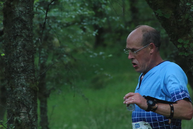
Planner's comments
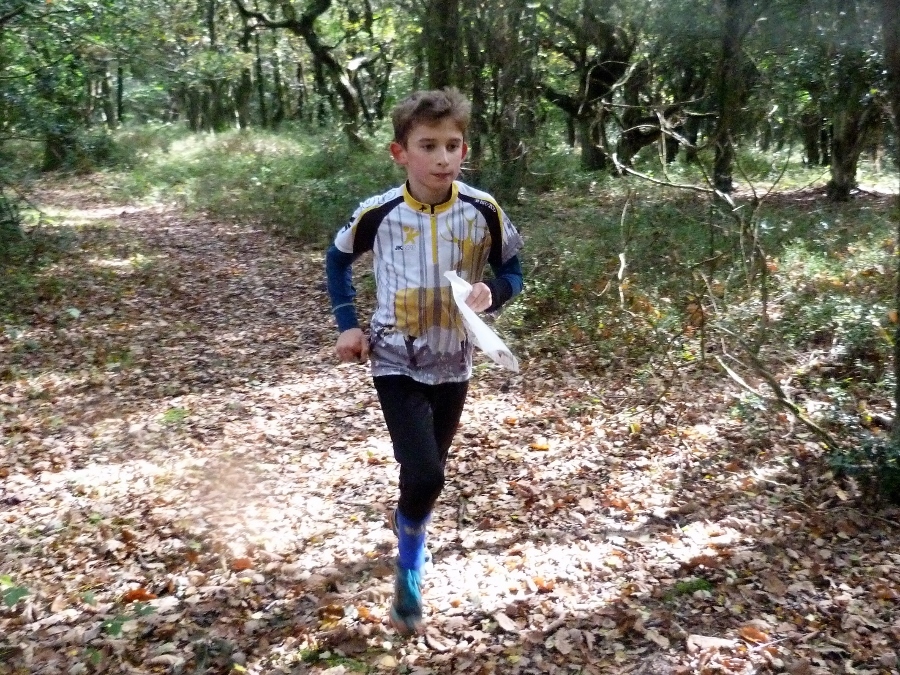
I hope everyone enjoyed the courses.
Having recently relocated to the Quantock region, this area was new to me and took a bit of getting used to, but I found the open, runnable forest with good visibility really enjoyable. In the main, the courses were designed to avoid gorse, brambles and heavier undergrowth which can sap both spirit and strength. The challenge was to avoid too many hard uphill slogs and I tried to get some legs on all courses which followed the contours or more gentle gradients. .
Brown and Blue, despite some big climbs, seem to have been well contested with winning times as expected. The climbs and relatively physical nature of the Green, Short Green and Light Green, seem to have spread competitors out a bit more – with some controls causing a little more difficulty in some cases - but with the weather improving over the event, most feedback seemed positive.
The Orange was possibly slightly too much of a step up from Yellow, with some more complex route choices and challenge from the first control onwards. Apart from one very rapid time, others were slower but nearly everyone completed the course – well done!
Times for Yellow and White looked about right and were well contested.
For the BTT runners it may have felt like beating the mud and gloop on the trail itself, but everyone got round in good time.
Being new, I was particularly grateful for all the help I was given, particularly from Ian Whitehead who stepped in to help recce and advise on the route, Bill Vigar for all the map changes and preparation, Chris Haslar for organising, Robert Green for calmly negotiating some technical issues on theSI and also Roger and Judy Craddock for all their knowledge, experience and support.
And of course, thank you to all the competitors for turning out and making planning worth while and for some useful feedback to incorporate in future events.
- Paul Chavasse
Show Pre-Event Info
Forest League (QOFL) Series Info
A local event open to all, beginner or experienced orienteer, young or old and there are colour-coded courses suitable for all.
We have six of these events a year and together they form the Forest League (QOFL). The series starts in the Autumn and continues at approximately one event per month until the spring.
Link to QOFL team lists - members, please check which events you are down to help at
Directions / Parking
Pass the Foxy Bean Café at Adscombe (Grid Ref ST182378), and head on towards Great Woods.
At the Forestry Commission sign, take the left fork and follow the road (Adscombe Lane) through to the far western end of the woods, passing the camp, picnic area (public toilets are here on the left) and car parking.
At the end of the public road, keep straight on for about 800m then turn hard right up the forest road. This turn is at GR ST157377, or couple.craftsman.grant
Parking
is about 1km up the forest road, with a turning circle at the top. Please turn your car before your run, and park facing downhill. (For those who know the area, this is about 300m ESE from Dead Woman’s Ditch, but participants are not allowed to park there as the walk to registration would pass too close to the event area!)
There will be no parking charge.
The walk from Registration to the Start, and from the Finish to Download is about 500m.
Course Information
Suitable for all ages and abilities.
Course lengths and climbs:
| Course | Length | Climb |
|---|
| Beat the Trail | about 7k | 210 m |
| Brown | 7.5 k | 290 m |
| Blue
| 5.5 k | 215 m |
| Green
| 4.1 k | 150 m |
| Short Green
| 2.9 k | 110 m |
| Light Green
| 2.9 k | 140 m |
| Orange
| 2.4 k | 100 m |
| Yellow
| 1.9 k | 110 m |
| White
| 1.4 k | 70 m |
Though a Brown course is being offered, those who run it will only score for the Devon League, not the QOFL, which goes up to Blue level only.
On the longer courses, experienced under 16s can run accompanied, but those less experienced need to be accompanied by a responsible adult, as there are up to four unmanned road crossings. There will be a road crossing marshall in post until 12.30.
Colour coded courses explained (with thanks to Berkshire OC)
Entry Details
Entry on the day (EOD)
This will be available for as long as limited map stocks last.
Please use the registration form here.
It must be checked to ensure it is fully completed. This is important for safety, back-up, and speed of entering details.
This form can also be obtained on the day from parking marshalls.
Costs
| Category of entry | Orienteering
| Beat the Trail |
|---|
| Adult
| 8
| 10
|
| Junior
| 3
| 5
|
| Family*- separate runs
| 16
| n/a
|
| Group (1 dibber and up to 2 maps)
| 8
| n/a
|
*The family rate is a concessionary rates. Maximum two adults per family.
SI card (dibber) Hire - standard is £1, contact-less is £2 (only if contact-less mode is activated)
Additional runs (for all)- £1 each
Charge for lost dibber - £40 (SI), £65 (SIAC)
The non-member premium has been dropped for 2019/20.
Electronic timing
The Sportident (SI) timing system will be used but contact-less punching (SIAC) will not be enabled.
Those of you who have your own SI card please bring it to registration to speed up the registration process.
Registration & Start Times
Registration from: 10:30 (helpers from 10.00)
Start times from: 11.00 to 13.00 (helpers can start from 10.30)
Courses close: 14:30
Terrain Description
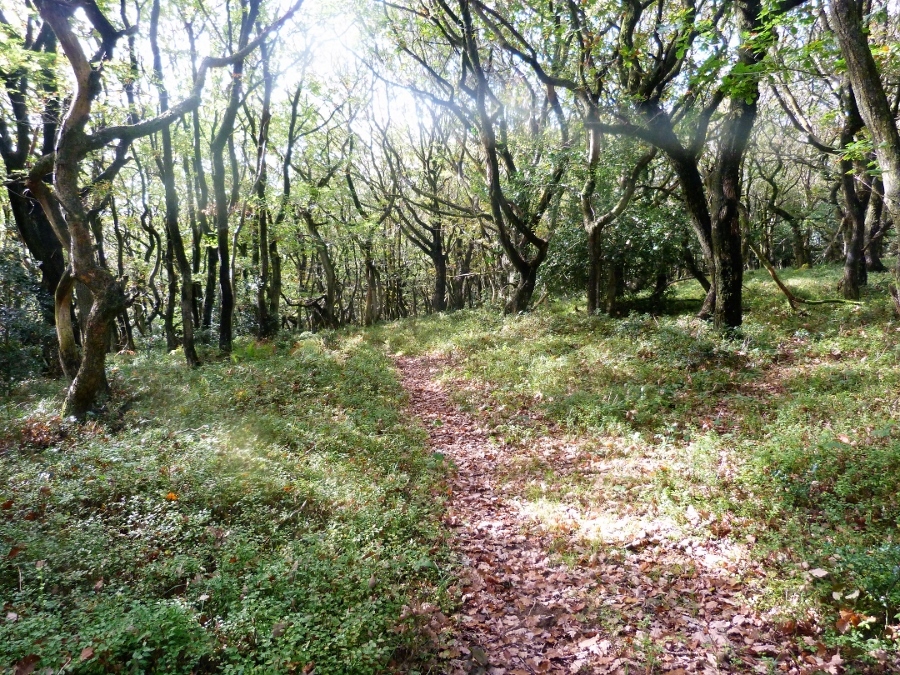
Most of the terrain is open, very pleasant and runnable forest with good visibility. Typically for the Quantocks the longer courses have some steeper climb.
Dog restrictions
Dogs are allowed on the courses, but must be under close control and well-behaved. This is due to ponies and sheep in the event area.
Course notes/ map
In open areas undergrowth can grow up over the summer, but over the winter much such as bracken (but not gorse) has died down and reasonable progress can be made across most open areas.
In the open forest many of the features are not that large - e.g. shallow depressions and platforms and cairns of c. 0.5m; in the south of the area some knolls on the map are distinctive anthills marked with a 'star' symbol on control descriptions.
Close any gates behind you please.
Map scale
Waterproof maps will be produced at 1:10,000 scale for the Beat the Trail course and the Brown, Blue, Green, Short Green and Light Green orienteering courses.
The White, Yellow and Orange courses will use a 1:5,000 scale – these courses are broadly similar to the JOG courses Hare, Squirrel and Badger.
Road crossings
The Beat the Trail course, and the Brown, Blue, Green and Short Green courses all cross the road. Under 16s wishing to do these courses should be accompanied by an adult runner.
Other users
As usual when we run in popular venues, we share the area with members of the public. Please be aware of dogs, horses and mountain bikers.
First Aid
First Aider at registration. The nearest A & E Hospital is at Musgrove Park Hospital, Taunton, TA1 5DA.
Weather precautions
In the event of poor weather, carrying a whistle and wearing a cagoule or similar will be compulsory for all competitors. Be prepared!
Toilet facilities
Public toilets are available about a mile into the woods, on your left as you drive in. The picnic area will be on your right. There are NO toilets nearer to the event area
Contacts / Officials
Planner: Paul Chavasse
Planner's assistant: Bill Vigar 01823 680679
Organiser: Chris Hasler 01823 338921 captain@
Team: 2
Important Event Information
Insurance: Please note: Participants who are not members of British Orienteering are not covered by British Orienteering’s public liability insurance. By entering this event, you acknowledge that you are taking part at your own risk. For example, if you were to accidentally injure a member of the public or damage property during the event, you would not be covered.
Safety and Risk: A comprehensive risk assessment will have been carried out by the organiser, but participants take part at their own risk and are responsible for their own safety during the event. All participants must report to download whether they finish their course or not.
Privacy: when participating in our events/activities your name may appear in the results section of this website or in newspaper reports. Read our data protection page to see how we look after your personal data.
Photography: QO has an agreed policy on the taking of photographs at events, based on national guidance. This provides a sensible balance between the benefits and risks associated with the taking and use of images. If you are unsure about acceptable practice, please speak to the event organiser. Photos taken may be retained beyond the 2 year window for legacy purposes.
Safeguarding: QO is aware of it's responsibilities in safeguarding and child protection. To comply with The Child Safeguarding Practice Review and Relevant Agency (England) Regulations 2018, we now provide an email address for individuals to report concerns to the Lead Safeguarding Officer. This address is safeguarding@britishorienteering.org.uk.