Monkton Heathfield
SS2
Thu 14 Dec
Near: TauntonLevel of event: Local
Type of event: Race, Score, Urban, Night
Updated with photos, planner comments and the latest league tables.
Type of event: Race, Score, Urban, Night
Updated with photos, planner comments and the latest league tables.
My apologies for problems in the technology involved. Between Purple Pen, Google earth, kmls, kmzs, OCAD, OOMap, Open Street Map, tiling and coloured circles errors ensued. Additionally I know the numbering was correct at one stage and then that wasn’t used. There is nothing hugely hi tech but going through the process after a two year gap makes it hard to master confidently.
Steve’s input below I think is most helpful for me and others for future event production.
Won’t dwell on it and hope the good area, course challenges and social aspect made for an enjoyable evening. I know Alasdair will hopefully be able to produce some acceptable results - thank you.
Back to baking rock cakes for me now.
When I got back, I couldn’t resist trying to shed a bit more light the proceedings.
I took my GPS track and:
There are several different routes to generate the KMZ and KML files that are used by MapRun, and I think the features in OOM and MapRun have improved over time. Did you use ‘MapRun Create KML Course’ ? I think you can now create everything using OOM and the Create KML Course tool that includes a satellite image and do not need to use PurplePen and Google Earth. For me, it seems less complicated and reduces the risk of error by only using two sets of software. (Although, I don’t think they can handle different coloured circles!!)
Monkton Heathfield is an area of Taunton not used before. There is an interesting mix of traditional streets and new development interspersed with paths and recreation areas.
The event follows the usual Street Series format. Beware of the 20 mph speed limit all along the approach road to the village hall. The space booked is the Schofield Room which is front left of the building. It is well protected by a door mat but please remove any muddy shoes. Toilets are immediately through the main door and bags can be left with us in the room. Road trainers should be ok - there are some footpaths but have not been too slippery.
As the last event before Christmas the club has booked a room at the village hall from 6-8pm. There is ample parking and post run analysis can be fuelled by mince pies and mulled wine.
MapRun doesn't need kites, control units or dibbers. All users need is the smartphone (or smartwatch) app. Immediately after your run, you can upload your score and time to the web and compare how you did with others.
Further information about this and all other events in the current series - please read before competing
It's worth reading our MapRun User Guide if you are new or having problems.
Series administrator: Alasdair Shaw
On the day organisers: Roger and Judy Craddock 01823 323850 jandr.craddock@gmail.com
Please read the Participant Code of Conduct and, if appropriate, the Parent Code of Conduct. Attendance at the event indicates that you accept them.
Three courses are offered, Long, Short, and Accessible. Long and Short use exactly the same controls and you can decide between them on the night.
All are "Score" courses, meaning there isn't a set order to the controls you visit.
Short Score - the order of the controls you want to visit is entirely up to you.
Long Score - odds and evens format used. That is, there are two sets of controls, odd numbered controls and even numbered ones, one set tackled after the other (running through two of a particular colour sets your first block and then two of the other colour switches you). Once you switch to the second set, you cannot go back to the first set. The control circles on the map are coloured red on one set and blue on the other. The colours are meaningful only for the Long score.
Accessible - wheelchair friendly. It is an adapted version of the Short course with width restrictions, steps, etc. marked and inaccessible controls removed.
The optimum routes are typically between 7.5 and 10 km for the long and 6 to 7.5 km for the short.
Each course has a time limit of 50 minutes.
Points will be deducted at a rate of 30 points per minute for each minute or part minute you're late back.
Points values for controls are variable and denoted by the first number of the control, e.g. 62 scores 60 points.
| Class | Pre-entry | On the night entry |
|---|---|---|
| 16+ | £5 | £6 |
| under 16 with accompanying adult | £5 | £6 |
Pre-entry and payment online is preferred. Payment on the night using contactless or cash is possible but you risk us having run out of maps.
Please consider buying a pack of pre-entry credits in advance. This costs you the same but saves the club a lot in credit card fees.
Evening event.
Start times from 18:00 to 19:00.
Courses close at 20:00.
Planner: Rosie Wych
Insurance: Please note: Participants who are not members of British Orienteering are not covered by British Orienteering’s public liability insurance. By entering this event, you acknowledge that you are taking part at your own risk. For example, if you were to accidentally injure a member of the public or damage property during the event, you would not be covered.
Safety and Risk: A comprehensive risk assessment will have been carried out by the organiser, but participants take part at their own risk and are responsible for their own safety during the event. All participants must report to download whether they finish their course or not.
Privacy: when participating in our events/activities your name may appear in the results section of this website or in newspaper reports. Read our data protection page to see how we look after your personal data.
Photography: QO has an agreed policy on the taking of photographs at events, based on national guidance. This provides a sensible balance between the benefits and risks associated with the taking and use of images. If you are unsure about acceptable practice, please speak to the event organiser. Photos taken may be retained beyond the 2 year window for legacy purposes.
Safeguarding: QO is aware of it's responsibilities in safeguarding and child protection. To comply with The Child Safeguarding Practice Review and Relevant Agency (England) Regulations 2018, we now provide an email address for individuals to report concerns to the Lead Safeguarding Officer. This address is safeguarding@britishorienteering.org.uk.
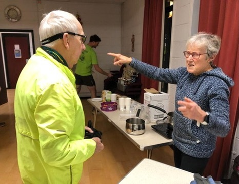
Planner Rosie talking to Roger
Credit:
Judy Craddock
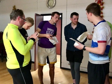
Discussing routes
Credit:
Judy Craddock
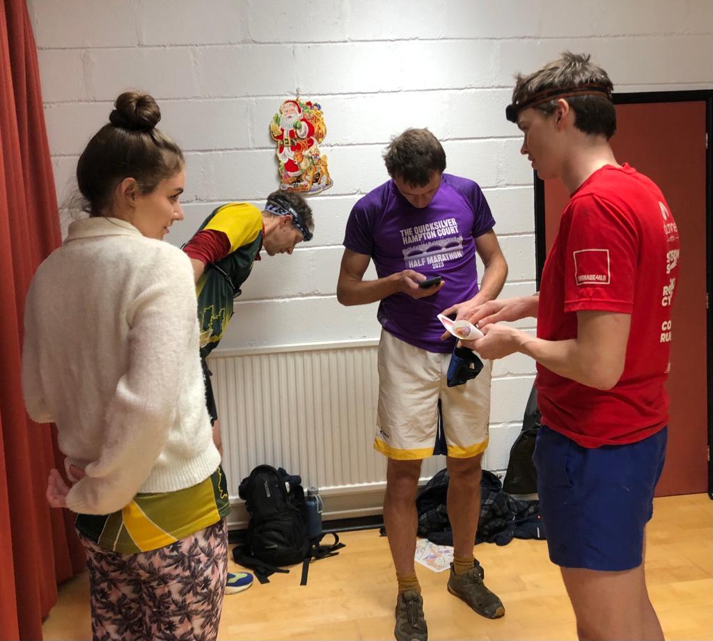
Miffy and Simon
Credit:
Judy Craddock
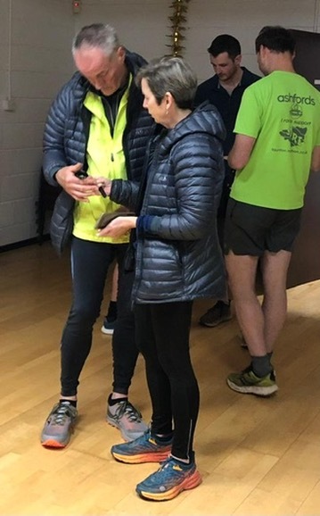
Post run analysis
Credit:
Judy Craddock