Show Pre-Event Info
Forest League (QOFL) Series Info
A local event open to all, beginner or experienced orienteer, young or old and there are colour-coded courses suitable for all.
We have six of these events a year and together they form the Forest League (QOFL). The series starts in the Autumn and continues at approximately one event per month until the spring.
Link to QOFL team lists - members, please check which events you are down to help at
Directions / Parking
Car sharing is encouraged, to help minimise the distance the average competitor will have to walk.
Because of the recent wet weather, the two fields we normally use won't be used, unless the landowner passes them fit for use after an inspection, scheduled for the morning of the event.
Parking will otherwise be on the road stretching SE from Birches Corner towards Park End.
Please do not use the public car park that is accessed by the single track from Birches Corner. Helpers arriving early can park around Birches Corner.
Please follow the instructions from the marshals.
Because of the risk of collision, under 16s should be accompanied along the road to registration.
The event will be signposted from the crossroads at the site of the now derelict Pines Cafe at ST207329 and then from Park End ST189331.
Course Information
Suitable for all ages and abilities.
NEW for this event is our Beat the Trail course - Read more here
Course lengths and climbs, subject to final planning:
| Course | Length | Climb | Controls |
|---|
| Beat the Trail | 7 k | 150 m | 12 |
| Blue
| 5.2 k | 285 m | 21 |
| Green
| 4.6 k | 150 m | 17 |
| Short Green
| 3.4 k | 105 m | 14 |
| Light Green
| 2.9 k | 100 m | 9 |
| Orange
| 2.8 k | 65 m | 10 |
| Yellow
| 2.5 k | 60 m | 11 |
| White
| 1.8 k | 40 m | 8 |
Colour coded courses explained (with thanks to Berkshire OC)
Map scale
White and Yellow are at 1:5000. All other courses are at 1:7500.
Locations
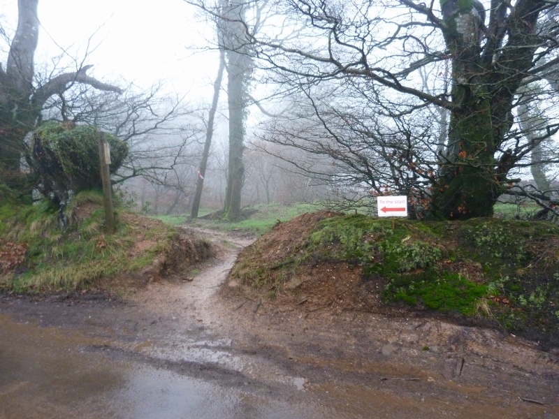
Registration is at Birches Corner.
The Start is located about 350m from Birches Corner, along a footpath.
There is a road crossing between Registration and the wood where the Start and Finish are located. Cars can emerge suddenly from the road serving the hill. Under 16s should be accompanied by an adult or follow the instructions of the road crossing marshall, adjacent to Birches Corner.
Parking stretches from adjacent Birches Corner (for early arrivers) back down towards Park End.
The Finish is about 600m from Birches Corner, along a track.
Entry Details
| Category of entry | Orienteering
| Beat the Trail |
|---|
| Adult
| 8
| 10
|
| Junior
| 3
| 5
|
| Family*- separate runs
| 16
| n/a
|
| Group (1 dibber and up to 2 maps)
| 8
| n/a
|
*The family rate is a concessionary rates. Maximum two adults per family.
SI card (dibber) Hire - standard is £1, contact-less is £2 (only if contact-less mode is activated)
Additional runs (for all)- £1 each
Charge for lost dibber - £40 (SI), £65 (SIAC)
Filling out a Registration form (link) in advance will quicken up the entry process on the day.
The non-member premium has been dropped for 2019/20.
Electronic timing
The Sportident (SI) timing system will be used. Contact-less punching (SIAC) will not be enabled.
Those of you who have your own SI card please bring it to registration to speed up the registration process.
Registration & Start Times
Registration from: 10:30 (helpers from 10.00)
Start times from: 11.00 to 13.00 (helpers can start from 10.30)
Courses close: 14:30
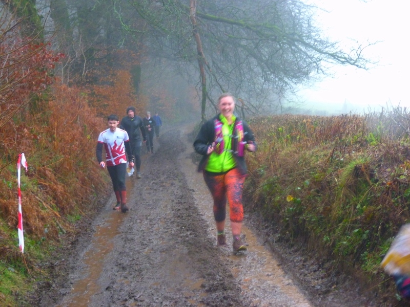
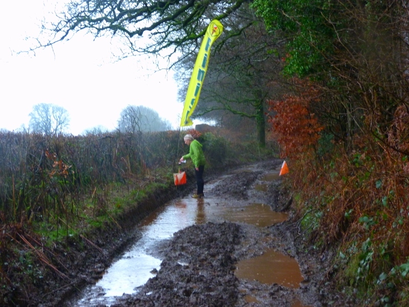
Terrain Description
Open hill tops with scattered woodland and a steep partially wooded valley in between. Point features include hides, knolls and root stocks.
Safety
Steep, slippy slopes particularly on the Blue course - please wear shoes with good grip. A leg on the Blue course passes through an area with a steep re-entrant mapped as a gully extending down the slope, which should be avoided primarily for safety but also because it would be a slower route.
Juniors courses- please bring a change of footwear and consider wearing wellies on the white / Yellow course.
The area is used by mountain bikers using the spine route along the Quantocks, horse riders and dog walkers. Please be courteous and understanding towards other users of the area.
Map
Most of the fences are mapped as being physically crossable but we have an agreement with the landowners that they should only be crossed at marked crossing points.
Courses tend to have controls at or near the crossing points- don't forget to dib these controls.
Legs that do not pass through the crossing point on the straight line route, so no advantage will be gained by avoiding the crossing points.
Please leave gates how you found them, the default being kept shut.
Mapping of vegetation provides rough idea of runnability but should not be relied upon for fine navigation.
Wind-blown trees shown where at or near control sites. Others may not be shown.
Recent gorse burning has made part of the hilltop more runnable. The map reflects the newly cleared areas.
Special symbol being used to denote pile of vegetation debris- see map legend.
Contacts / Officials
Planner: Angela Modica 01823 451647 buddyinfo@
Controller: Jeff Pakes 01823 321900 website@
Organiser on the day: Annabel Davis buddyinfo@
Organiser in advance: Brian Pearson 01823 252407 results@
SI Manager: Roger Craddock 01823 323850 president@
Team: 1
Important Event Information
Insurance: Please note: Participants who are not members of British Orienteering are not covered by British Orienteering’s public liability insurance. By entering this event, you acknowledge that you are taking part at your own risk. For example, if you were to accidentally injure a member of the public or damage property during the event, you would not be covered.
Safety and Risk: A comprehensive risk assessment will have been carried out by the organiser, but participants take part at their own risk and are responsible for their own safety during the event. All participants must report to download whether they finish their course or not.
Privacy: when participating in our events/activities your name may appear in the results section of this website or in newspaper reports. Read our data protection page to see how we look after your personal data.
Photography: QO has an agreed policy on the taking of photographs at events, based on national guidance. This provides a sensible balance between the benefits and risks associated with the taking and use of images. If you are unsure about acceptable practice, please speak to the event organiser. Photos taken may be retained beyond the 2 year window for legacy purposes.
Safeguarding: QO is aware of it's responsibilities in safeguarding and child protection. To comply with The Child Safeguarding Practice Review and Relevant Agency (England) Regulations 2018, we now provide an email address for individuals to report concerns to the Lead Safeguarding Officer. This address is safeguarding@britishorienteering.org.uk.