Longrun Meadow & environs
Urban
Thu 14 Jun
Near: Taunton
Level of event: Activity
Type of event:
Social
This a closed event being run for a private members' club from the Pitney area. Ray Toomer will be in touch by email to provide further details to those invited.
The course was launched at Our final Club Night of the 2017/18 season.

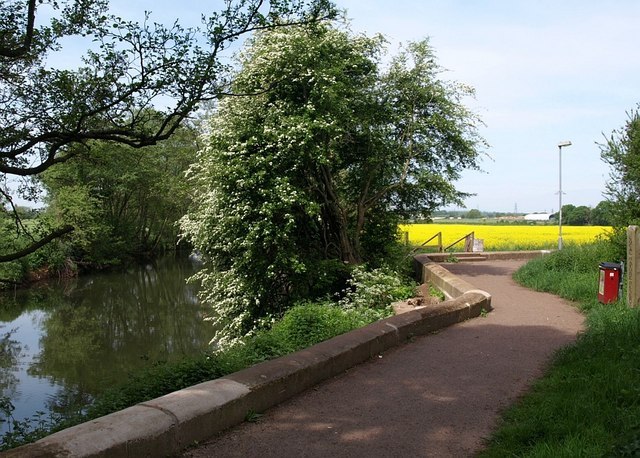
Finish control, French Weir Park
Credit: GoogleStreetview

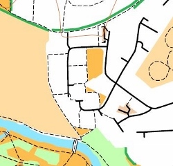
Location of Start
Credit: Photo- COACH website
Directions / Parking
Directions
A3027 from North.
A38 from all other directions.
Parking
Several car parks adjoining Taunton town centre are within walking distance. The council-run ones are free after 6pm.
Tesco has time-restricted car parking for shoppers (5 mins away).
On street parking in residential streets nearby.
Course Information
A one hour score course. The optimum route is about 5.5km, but could be 7km by taking less direct routes. The map you will receive contains most of the details below on its reverse.
Scoring
The 24 controls have varying points values, based on how tricky or far away they are. There are 500 points available, broken down as:
6 x 10-pointers = 60
10 x 20-pointers = 200
8 x 30-pointers = 240
The time limit is one hour - be careful, as lateness is punished harshly! 30 points will be lost for every minute (or part of) that you exceed the time limit.
Access
Download the MapRun app.
Choose 'Select Event' then choose the Chip Lane event.
It's in the following location:
MR UK/ MR Quantock Orienteers / Chip Lane a PXAS PZ1714062018 ScoreQ60
The course is PIN-protected until 17.00 on event day.
Before that, you would need to enter a PIN obtained from the organiser- the app wouldn't let you start your run otherwise.
Location of Start and Finish
Both are towards the bottom of the course map, in French Weir Park- see photo illustrations below
Start is a lamp post immediately to the S of the COACH building
Finish is a bench on the north east side of the park.
Please be careful not to go near the Finish once you've started- otherwise your race will end early!
Registration & Start Times
This is an evening event.
Terrain Description
Country and urban parkland, residential streets, civic amenities, car parks and riverside path network. The areas used are the country park of Longrun, French Weir Park, North Town, Frieze Hill and Roughmoor.
Map
Scale 1:5,000 (or 1cm for every 50m).
The map is sourced from Open Orienteering Maps, with selective map updates made Mar 2018 using Open Street Map.
Safety
Beware of multiple traffic and water hazards (rivers, flood basins and a pond).
Area is bisected by a main road running from North to East.
Suitable crossing points are shown on the map.
There are also alleyways and open fields.
Toilets
Unless access has been given to the COACH building, the nearest is in Castle Street, 10 minutes to the east on the west side of Taunton town centre (click for list)
Contacts / Officials
Organiser: Ray Toomer
Planner: Jeff Pakes website@

