The event was not well attended this year. One factor was fixture clashes, with two other moorland events nearby (Craddock Moor in Cornwall and a mountain bike O event on Dartmoor) plus a national event in the Midlands. Also, many forest orienteers, particularly QO ones, don't seem to find the open moor a great draw. Former long O champion Simon Beck gave us possible reasons why...
I went to the long O in the Badgworthy area (started at Pinkery Pond) a few years ago; it was OK but I thought once is
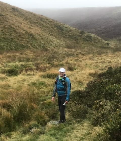
enough. Navigation can be challenging if it's a misty day (as this one threatened to be) and remains so until
the courses have closed, but there isn't the feeling of speed and movement one
gets when trees are whizzing past as you run through a forest and of course it
can become something of a lottery if the mist comes and goes through the day.
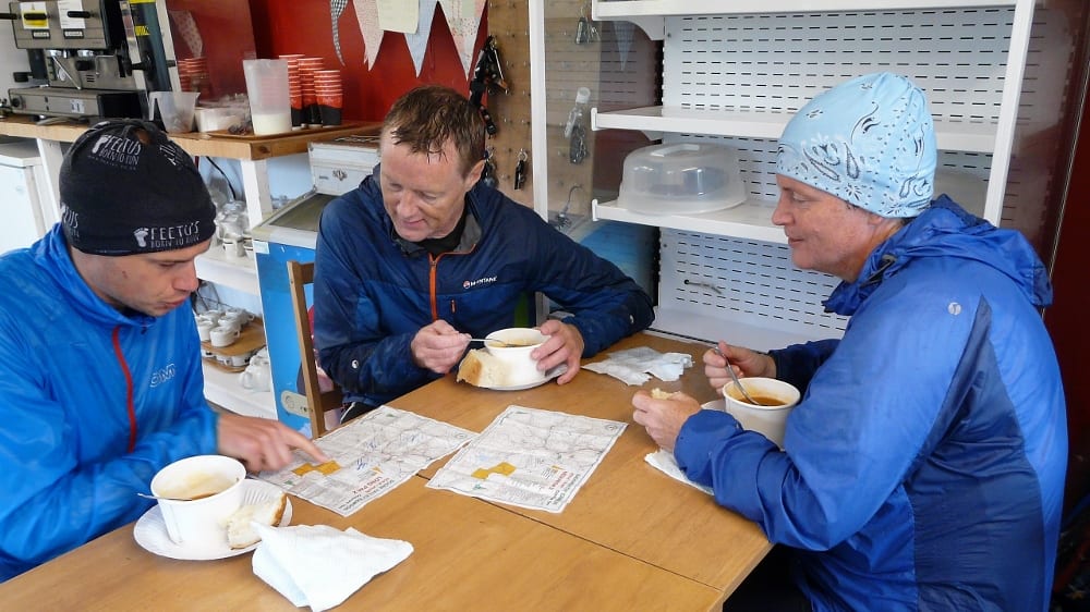
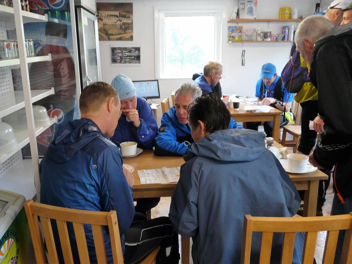
Certainly, quite a few only entered on day 1, perhaps reflecting what an excellent part of the Quantocks that area is. Weather did not appear to be a problem, with none of the predicted heavier rain or winds, at least not until it was time to collect the controls in!
Something to add?
If anyone who was there on Sunday has any comments or commentaries on their run or the day, please contact the web manager Jeff Pakes (see contacts page)
Show Pre-Event Info
Long O Series Info
The long event is ideal training for mountain marathons, particularly the OMM.
Link to our Long O section
Series Contacts
Organiser: Rosie Wych 01823 400744 rwych@hotmail.co.uk
Controller: Andy Rimes 01823 400744 andyr.qo@hotmail.co.uk
Planner: Martin Longhurst (Devon OC)
Directions / Parking
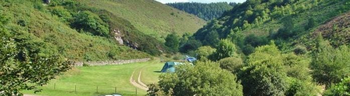
The event HQ is at Cloud Farm Campsite, Oare. The campsite is well signposted from the A39 just east of the County Gate car park.
Parking & toilets
Will be available close to registration – follow signs and direction as required.
Course Information
| Course | Length | Climb |
| Long | 18 k | 580 m |
| Medium | 13.5 k | 430 m |
| Short | 7.5 k | 310 m |
Different course lengths can be combined over the two days, although the small prizes on offer are only available to overall winners of the three courses combined over the two days.
Manned control
Will be passed on both the Long and Medium courses.
Will be open from 10.30 to 14.30, when the control will be removed.
Please ensure that your details are given to the official, in addition to using the electronic control. This is for your safety in case a search is needed.
Assistance may be possible to those seeking to retire at this stage.
The manpower will be there until 15.00 but late arrivals will be directed to retire either to the nearest road or the main valley route back to Cloud Farm.
Finish
Adjacent to the event centre.
It will not be manned.
Courses close
At 16.30.
Retirements
If runners retire they MUST report back to the event centre.
Please return directly to the finish if you are out on a course and unlikely to complete by closure time.
Entry Details
Online entries: now closed (link: Start list)
Please contact Rosie Wych before Saturday if you would still like to run so she can reserve you a map.
Entry on the day: a limited number of maps will be printed
Late entries: queries and payments will be dealt with at the registration desk for each event
At other times contact Rosie Wych 01823 400744 (until 08.00 on 30 September) or rwych@hotmail.co.uk
Who can enter
Participants may run as a pair.
The event is unsuitable for novices and unaccompanied juniors. These groups are restricted to Medium or the Short courses, at the discretion of the organiser.
Electronic punching type
SportsIdent (SI). Dibber hire is included in prices.
Costs
£12 (plus £2 for non-BOF members) on medium and long courses
£9 (plus £2 for non-BOF members) on short course
£6 for juniors
Entry fee includes the traditional home-made soup, bread, cake and hot drinks, served from the tea room.
Helpers entitled to a 50% discount- obtain discount code from the organiser for use on Fabian 4.
Registration & Start Times
Registration will be open from 09.00.
Together with dibber hire and late entries, will be located in or adjacent to the tea rooms.
Both start and finish are very close to parking and registration. Please be considerate of other users of the site and walkers on the footpaths which cross the area.
Car keys may be left at registration.
We will collect details of mobile phone numbers, emergency contact number and car registration.
Start times
Starts: 09.30-11.00.
Slower runners on the long course should start early.
The common start/finish will be manned only for the starting period.
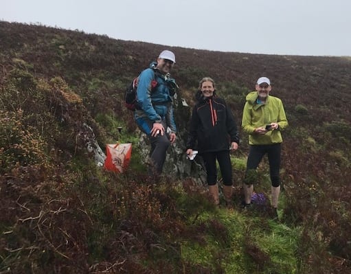
Terrain Description
Typical open moorland with steep river/stream valleys. Courses hopefully miss the worst ground but there are rough patches. See extra info further below.
Dog restrictions
May run with their minders, but bear in mind that there are sheep and cows in the area, the dog's
behaviour is your responsibility.
NO DOGS ON LONG COURSE
Safety
Exmoor is exposed and potentially subject to poor weather and changeable conditions.
If lost the main river valley runs north-south through the centre of the area and can be used to re-locate.
There is an emergency land line number on the map, however mobile coverage in the area is dreadful and cannot be relied upon even on high ground O2 and Vodaphone claim to have coverage on high ground and Three on the Brendon Two Gates road to the west.
Runners on long go close to a minor road in the south east.
Please take your mobile phone but appreciate the limitations.
Clothing & equipment
Please dress accordingly. You must carry a whistle, waterproof tops (with hood) and bottoms, hat and gloves, mobile phone. Some of these items may be removed if conditions on the day are very benign.
Ticks are indigenous in the region, and areas have some gorse/heather covering so lower leg cover is advised.
Those running longer courses must carry water/food for the duration.
Kit check at the start.
Map & terrain: further info
With limited manpower it has been impossible to fully update the large area used with some of this detail and seasonal vegetation.
There will however be a map (and pens for competitors to mark their own map) at the start showing some of the areas we have found it wise to avoid!
Many small animal tracks exist in addition to those paths shown on the map and streams tend to have paths running alongside.
Further information will be displayed at registration if deemed necessary.
Crossing points
Are not compulsory but we have assured the owners that fences will not be damaged.
Some stream crossing points and bridges are shown on the map.
Competitors must use bridges if there is a spell of wet weather.
Gates
Most of the crossing points are gates. The default state of all gates is CLOSED. If you find one open please close it behind you. This has been emphasised by the owner of Cloud Farm - his sheep in various fields must not be allowed to mix!
Accommodation
Cloud Farm campsite offers a base in an idyllic, secluded river valley adjacent to the competition area.
Contact number: 01598 741278
Plea for help to QO members!
Putting on this event is quite a big undertaking for the small team who run this event for the benefit of those who are coming from far and wide. We need more people to help us run this event, please click here to read a message from the organiser
If you can help us, please contact the organiser (details below).
Important Event Information
Insurance: Please note: Participants who are not members of British Orienteering are not covered by British Orienteering’s public liability insurance. By entering this event, you acknowledge that you are taking part at your own risk. For example, if you were to accidentally injure a member of the public or damage property during the event, you would not be covered.
Safety and Risk: A comprehensive risk assessment will have been carried out by the organiser, but participants take part at their own risk and are responsible for their own safety during the event. All participants must report to download whether they finish their course or not.
Privacy: when participating in our events/activities your name may appear in the results section of this website or in newspaper reports. Read our data protection page to see how we look after your personal data.
Photography: QO has an agreed policy on the taking of photographs at events, based on national guidance. This provides a sensible balance between the benefits and risks associated with the taking and use of images. If you are unsure about acceptable practice, please speak to the event organiser. Photos taken may be retained beyond the 2 year window for legacy purposes.
Safeguarding: QO is aware of it's responsibilities in safeguarding and child protection. To comply with The Child Safeguarding Practice Review and Relevant Agency (England) Regulations 2018, we now provide an email address for individuals to report concerns to the Lead Safeguarding Officer. This address is safeguarding@britishorienteering.org.uk.